Transform your mobile device into a powerful marine navigation app
Turn your iPad, iPhone or Android device into an advanced, yet easy-to-use marine navigation system that surpasses panel-mounted chart-plotter systems.

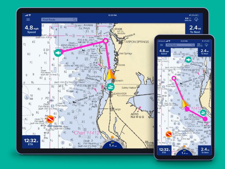
Meet The Pro Charts™ Marine Navigation App
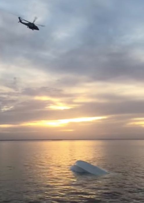
Father's marine navigation app helps rescue son
Jay Stipe, the developer of the PRO CHARTS™ app, received a frantic call. His son's boat had capsized somewhere in the Gulf of Mexico…
Navigate accurately. Get there safely.
Whether you’re a jet-skier, a weekend cruiser, a sailboater, a serious fisherman, or an offshore captain needing to find an exact location hundreds of miles offshore, PRO CHARTS™ will get you where you need to go and back home safely – with nothing more than your Apple or Android devices.
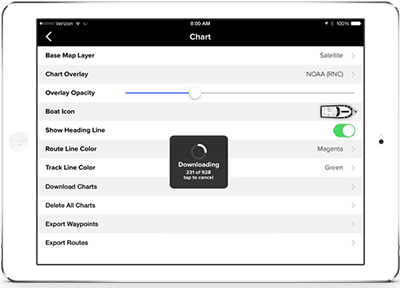
NOAA charts with depths
View detailed NOAA marine navigation raster charts with depths and other important information. Or choose NOAA ENC charts, satellite or other maps.
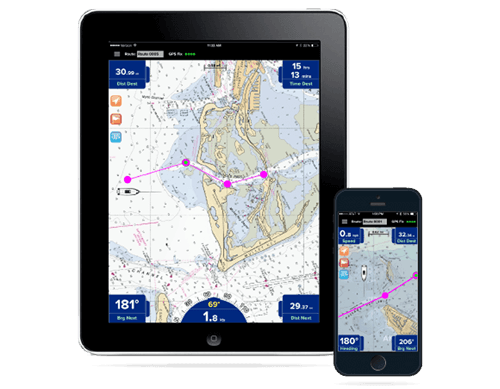
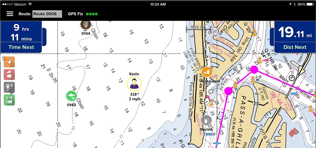
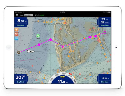
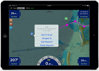
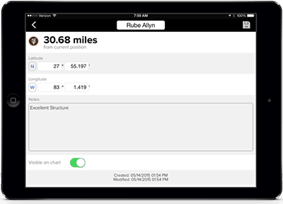
Plan routes and set waypoints
Quickly create and save routes. Save important waypoints such as favorite fishing and dive spots, launch points, fuel locations, favorite dockside restaurants and more.
One-touch waypoint and route creation
No special modes or confusing menus like other navigation apps. Just touch the screen to add a waypoint or create a route.
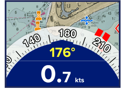
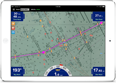
Accurate point-&-steer navigation
The red heading bug on the large on-screen compass always directs you to the next point on your route. Navigation is as easy as pointing your boat at the heading bug to stay on course.
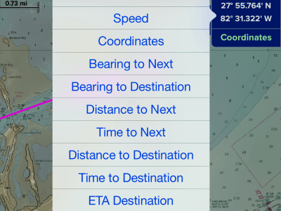
Destination, direction, ETA & other live info
Just touch any of the Nav Data windows to select what you want to see. You can also hide any or all of the windows to maximize your view of the chart.
Continuously up-to-date maps
When was the last time you updated the chart data on your panel-mounted chart plotter? If you’re like most boaters, probably never. NOAA releases new chart data every seven days and with a PRO CHARTS™ subscription, your data is continuously updated.
Works with no internet access
PRO CHARTS™ is designed so no internet connection is required to view your charts while out on the water. You simply download in advance any charts you’ll need at sea with the touch of a button.
Sync your waypoints across devices
No need to re-enter data on your Apple & Android. You can sync your waypoints on all your devices with just the touch of a button.
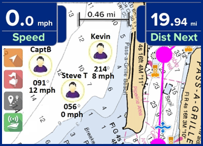
Find your boating friends
View your friends' locations on the map. Locate that sandbar party, track participants in a fishing tournament, monitor your loved ones as they are out on the water, or even help out a buddy in distress.
Great app! I’ve used Simple Charts for 2 years and loved it, but the new Pro Charts™ version is even better.
I don't use this app very often, but when I need it, I have excellent maps at hand. It's easy and practical to use.
Get PRO CHARTS™ for iOS or Android