PRO CHARTS
Plan your trip at home on your couch, not at the dock!
Have you ever sat at the dock trying to enter a route into your chart plotter while the rest of your group is ready to go? With Pro Charts, you can enter waypoints, create routes, and check the weather, tides, and currents to plan your entire trip before you ever leave the house!
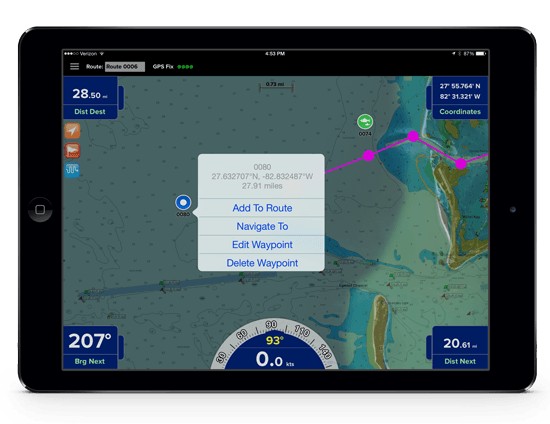
Easy one-touch Waypoint and Route creation
Pre-plan your routes at home or create them at sea with equal ease. Pro Charts’ unique user-interface design requires no special modes or confusing menus like other navigation apps. Just touch the screen to add a Waypoint or create or Route.
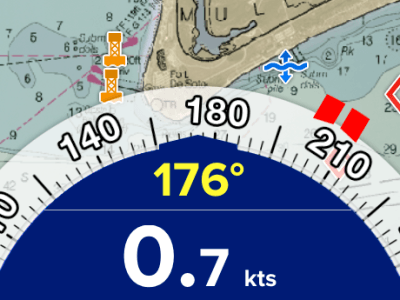
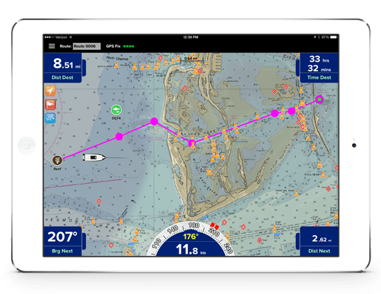
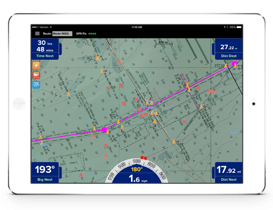
Easy point-and-steer navigation
The red heading bug on the large on-screen compass always directs you to the next point on your route. Navigation is as easy as pointing your boat at the heading bug to stay on course.
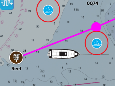
Find your friends on the water
With our user-tracking feature, you can see your friends or other Pro Charts users while you’re out on the water! When you’re on your secret spot and don’t want to be seen, you can hide your location with the touch of a button.
Continuously updated data
When was the last time you updated the chart data on your panel-mounted chart plotter? If you’re like most boaters, probably never. NOAA releases new chart data every seven days and with a Pro Charts subscription, your data is continuously updated.
Select the type of chart you want
Pro Charts includes scanned NOAA raster charts, electronically-generated NOAA ENC charts, and more so you can choose the view you like best.
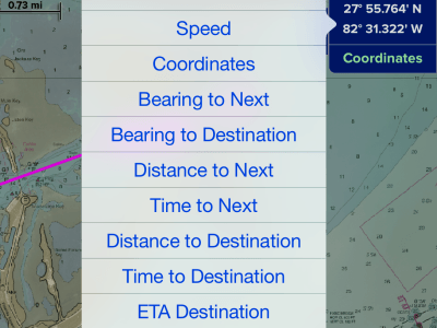
Configurable data displays
Just touch any of the Nav Data windows to select what you want to see. You can also hide any or all of the windows to maximize your view of the chart.
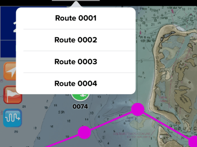
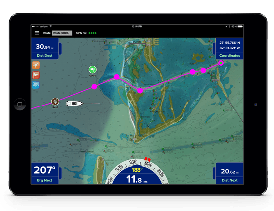
Easy route selection
Use the Route Selection window to quickly activate any of your saved Routes. Heading home at the end of the day is as easy as selecting another route or touching anywhere on the route line to reverse the current Route.
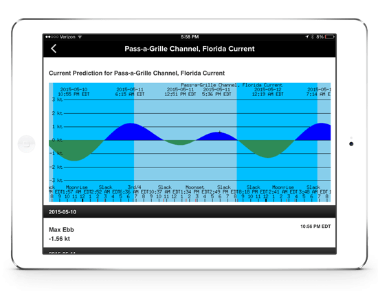
Weather, Tides, and Currents
Need to know when low tide will be? Wondering what the weather is doing? No problem. Just touch any of the Weather, Tides, or Currents icons to display up-to-the-minute information.

Synchronize your data
No need to re-enter data on your Apple or Android. You can sync your waypoints on all your devices with just the touch of a button.

Continuously available charts
Pro Charts is designed so no internet connection is required to view your charts while out on the water. You simply download in advance any charts you’ll need at sea with the touch of a button.
Get PRO CHARTS™ for iOS or Android